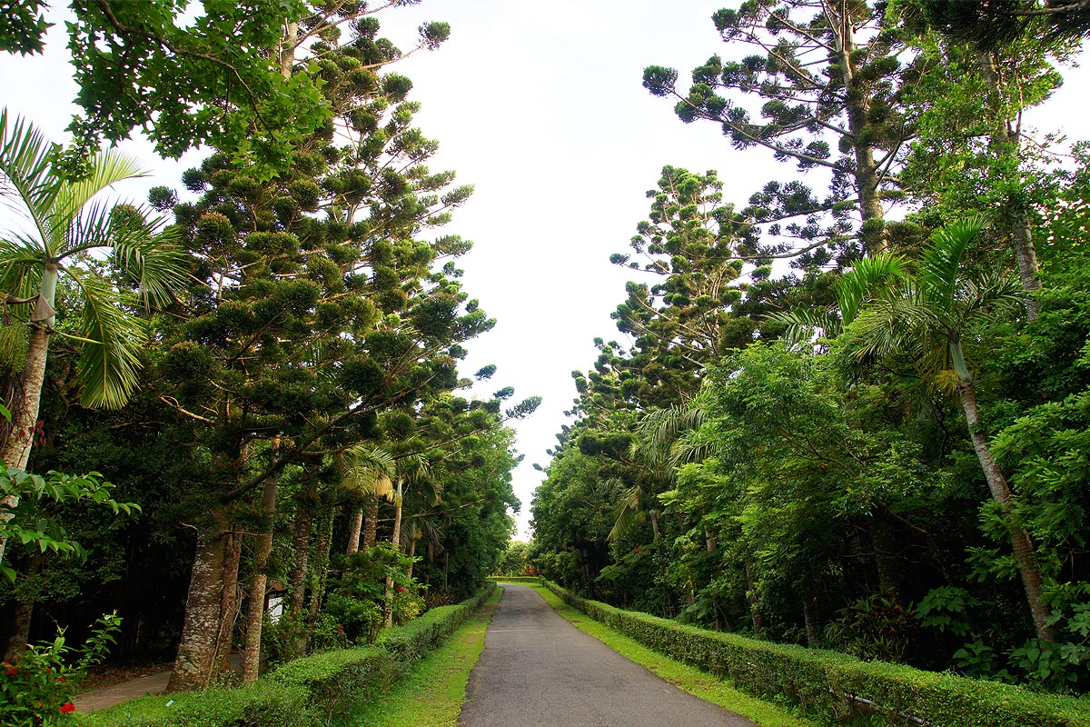
Kenting forest recreation area
The Shirding tribe of the people used to live near the recreation area, and during the Japanese Occupation period, over 513 tropical plant species were brought in, and after retrocession, the Hengchun branch of the Taiwan Forestry Research Institute, Council of Agriculture, Executive Yuan took over, and named it the Kenting tropical botanical garden. In 1967, the Forestry Research institute established the Kenting forest recreation area, which allows academic research while still able to provide education and entertainment to the public.
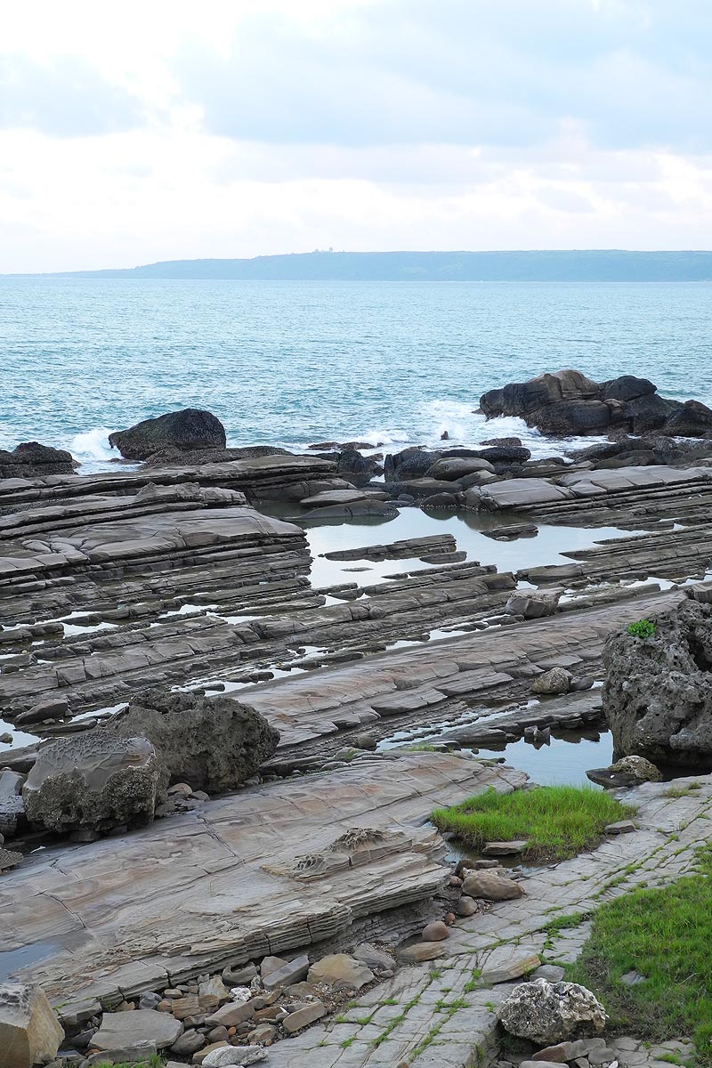
The area is 200-300m above sea level and covers 435 hectares, accounting for 2.5% of the land mass in all of Taiwan’s national park. Currently, 76 hectares of the land has been developed.Remains of coral reefs can be found throughout the area, and as the reefs are formed from accumulation and deposits of coral shellfish and algae, This area was certainly at the bottom of the sea some time in the past ten thousand years ago. Over 1200 species of plants can be found spread between the coconut, grease, rubber, medicinal, and tropical fruit areas. Abundant shades flanks the paths with the colorful plants everywhere, giving you no time to rest as you take in all the sights.
Information: Kenting National Park website
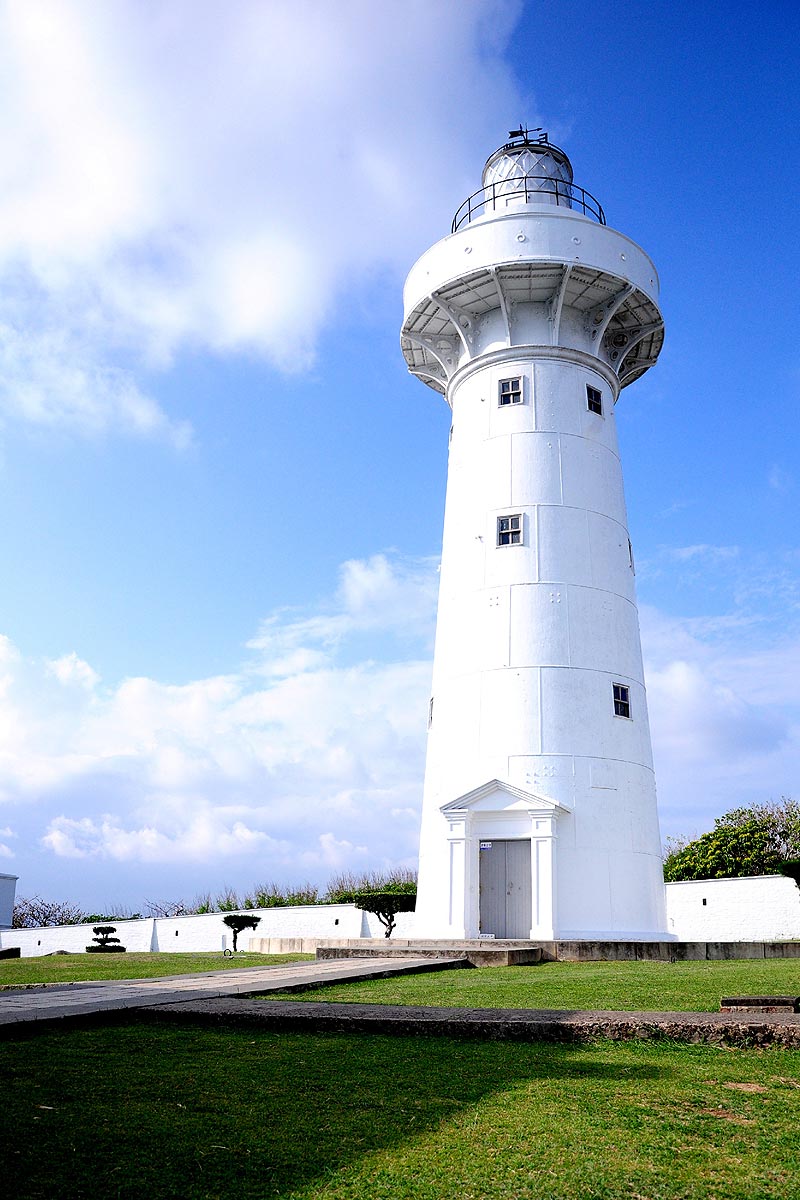
Eluanbi lighthouse
Eluanbi park covers 59 hectares and is situated at the southernmost part of Taiwan. On its east side is the Pacific Ocean, while touching Bachi Strait on the south. Scenic spots in the park includes haohan rock, canghai pavilion, you-yi village, Yu valley, Ying-bing pavilion, Lie-zhu pavilion, Xiang-feng rock. The coastal trail which follows the reef coast is particularly recommended, immersing you in nature amidst the expansive oceran view and the slightly salty ocean wind. The park takes approximately 1.5 hours to cover on foot.
The establishment of Eluanbi lighthouse was due to the constant shipwrecks that occured near Qi-xing rock during the Qing Dynasty, as western trade ships were unfamiliar with the seas of the Taiwan Strait. The lighthouse was built in 1882 with a fort and gunports; it is a rare example of an armed lighthouse.
The lighthouse was destroyed in various wars, and after retrocession, the government rebuilt the structure according to its original specifications. The lighthouse is 21.4m tall, providing over 1.8 million lux from its light, and is the brightest lighthouse in Taiwan. It is still currently operational and guide ships through Taiwan Strait. It is also known as the light of East Asia, and is preserved as a monument.
Information: Kenting National Park website
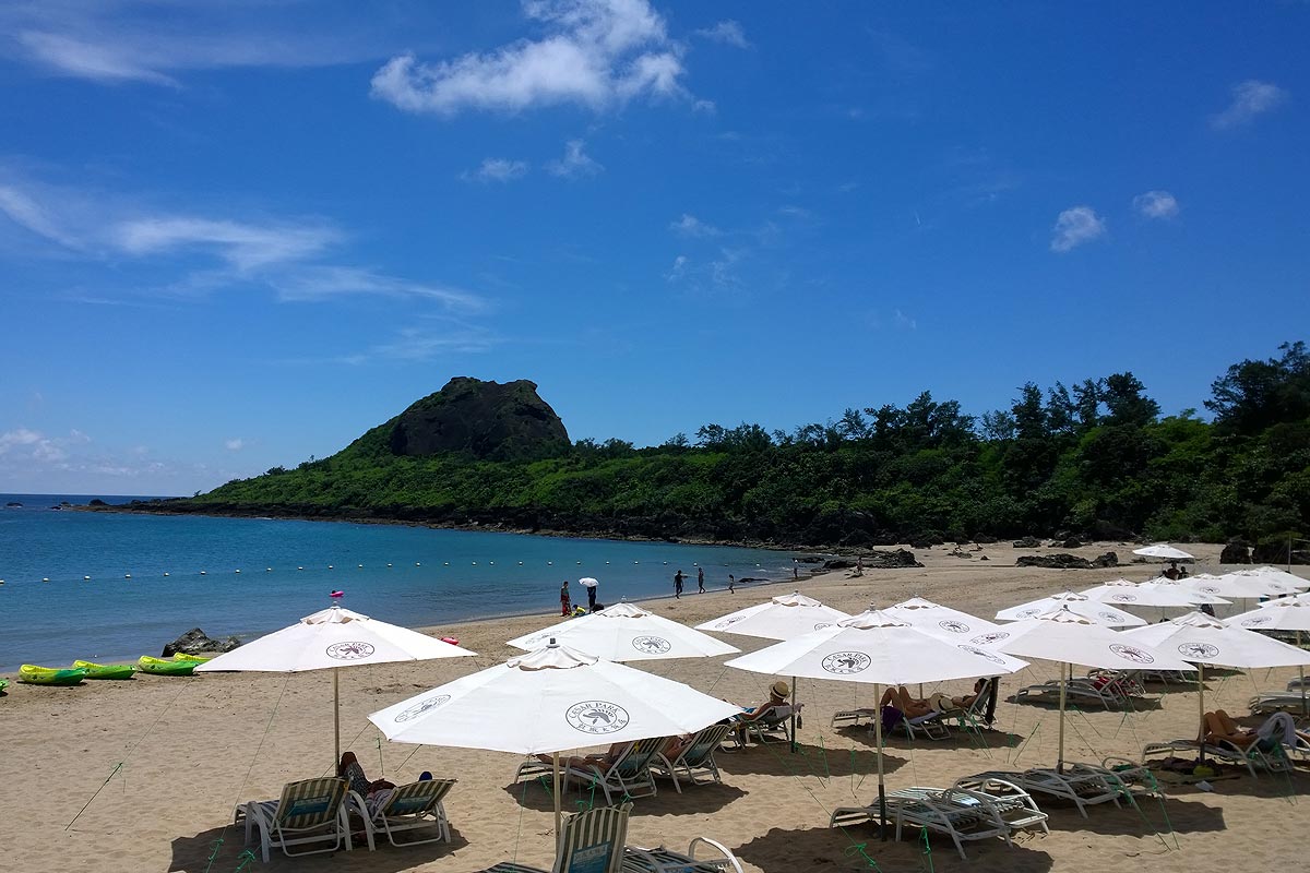
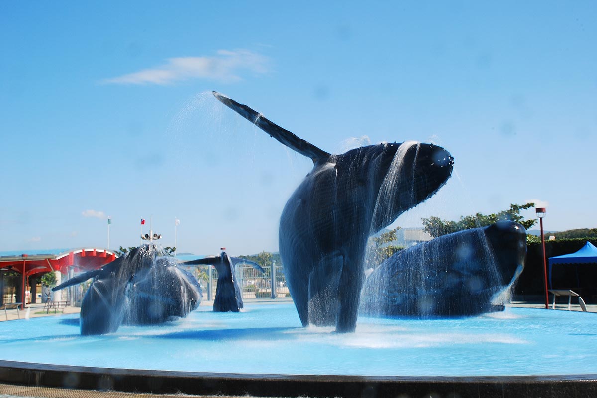
Little Bay beach
Little Bay is at the end of the Kenting stree, and is directly in front of the Kenting Caesar Park. It is a popular beach for tourists. During the day, you can engage in various non-power water activities, while at night you can watch the start and listen to the waves. It is a favourite nighttime strolling spot for tourists as it is very convenient.
Little Bay beach is highly attractive to foreign tourists who are most often found sunbathing, creating a exotic atmosphere. As there are usually a lot of people engaged in water activities in this area, there is a designated swimming area with professional lifeguards to provide a safe environment. Rental services are also available for umbrellas, deck chairs, swim rings, wind/surf boards, beach volleyball, and rubber dinghies. It is a definitely must-see hotspot when you visit Kenting!
Information: Kenting National Park website

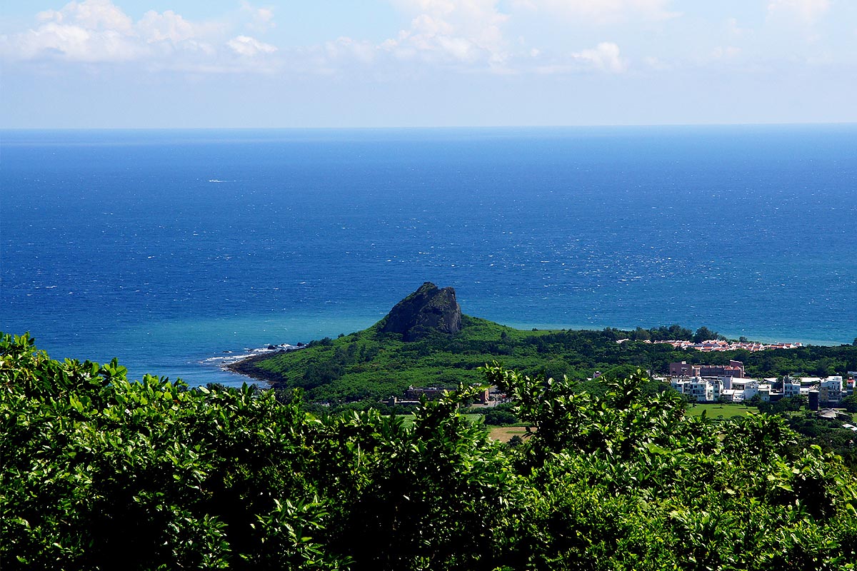
Chuanfan Rock (sail rock)
From Shirding Park, follow the new road south approximately 4km, a giant rock standing in the saves can be seen, looking like a sailboat that is about to set sail, hence its name sake. Upon a closer look, it may resemble the head of the former US president Nixon, giving it a different amused outlook.
Chuanfan rock is approximately 18m tall, and rolled from nearyby plateau ono the old coral reef in the sea. It is harder than the surrounding reef rocks, enabling it to remain standing in the sea over time, and evidence of this can be seen from the plateau above where its massive coral rock are visible.
Information: Kenting National Park website
National Museum of Marine Biology
The environment on land has been massively disrupted by humans, and the oceans which covers 70% of the Earth’s surface is bound to be the space for future development. However, if we do not understand it, we will not care for it or protect it, never mind implementing sustainable management for it. In light of this, the National Museum of Marine Biology was established in February 1990 in Kenting National Park in the coastal foothill area of Jiao-gui mountain.
The museum has three areas: the Taiwan waters area, coral kingdom area and world waters area, providing information about fishes in Taiwan, coral ecology, as well as information on the ancient ocean and arctic water.
The establishment of the National Museum of Marine Biology is not only to meets the educational, cultural, economic and other goals se by the government, we also hope to help people learn how to respect and protect the environment, so that everyone can do their part in the development of the world in the future.
Information: Kenting National Park website
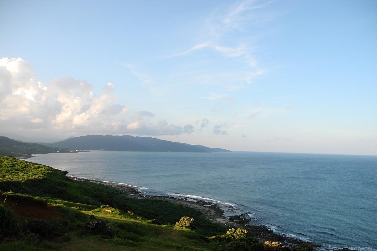
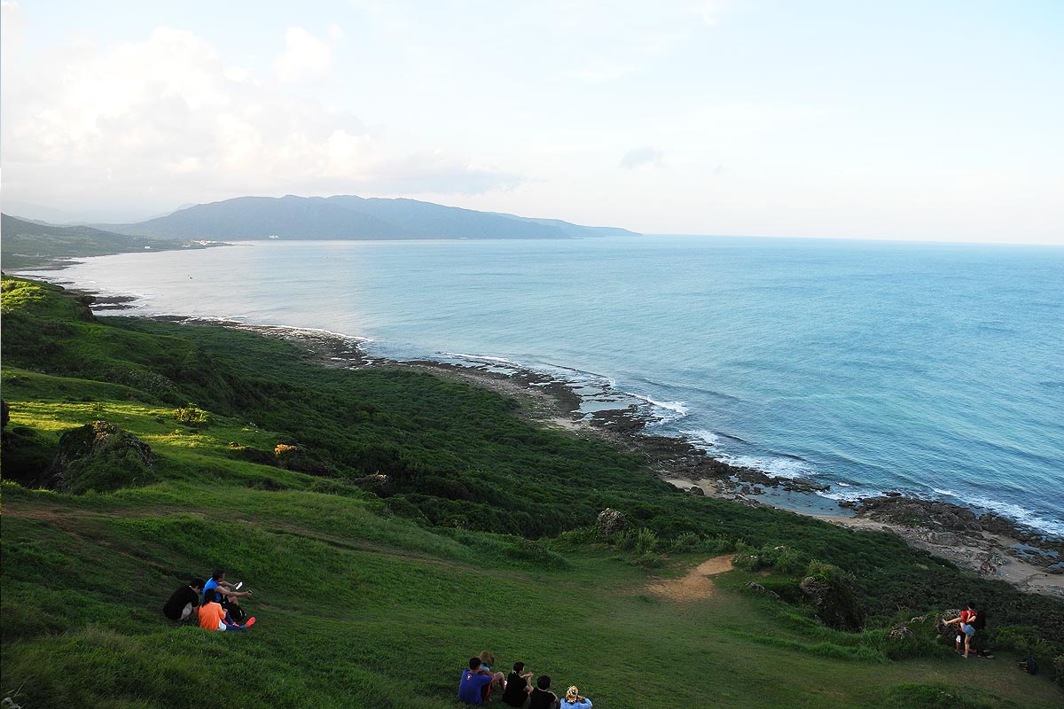
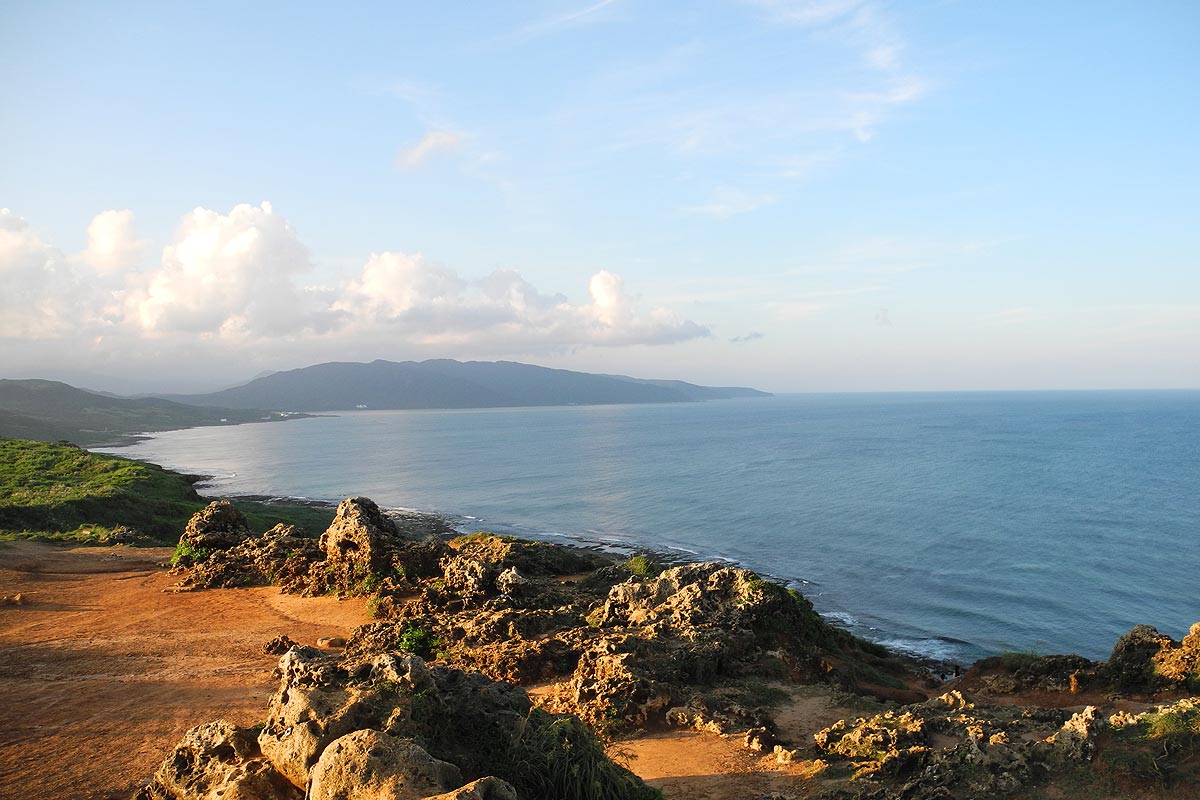
Longpan Park
Going north on Jia-E highway which follows the eastern coast from Eluanbi, there is an expanse of grassland next to the vast Pacific Ocean - this is Longpan Park. This area is a raised limestone plateau, and as limestone is prone to water erosion, collapsed cliffs, sinkholes, limestone caves and red clay terrain all can be found here.
In the summertime, the area is green and covered with flowers, occasionally skylarks can be seen twittering and flying about, making it a relaxing sight to behold.
On the expansive grassland, you can see the twist and turns of the coastline, the steep cliffs, and for city dwellers, it is the perfect place to watch sunrise or the starry night skies.
Information: Kenting National Park website
Jialeshuei
Jialeshuei is part of Manzhou Township. It was formerly known as Jialashuei, which in Taiwanese means waterfall. When former president Ching-kuo Chiang visited the area in 1975, he changed the name to Jialeshuei, and named the previously nameless waterfall Shan-hai waterfall. After this, the area became more and more popular among tourists.
A large number of interestingly shaped rocks and stone are found here, shaped by the constant erosion of strong wind and waves, such as frog rock, rabbit rock, ball rock, square rock, beehive rock, and so forth. These works of nature are found along a 2.5km stretch of the coast, and are bound to amaze you.A large variety of animals can be found here. Schools of colorful fishes of the pellet and laborid genus can be found weaving through the rockpools and the marshy areas inside the coast. Lobsters, various shellfish species and mudskippers can also be seen here.
Information: Kenting National Park website
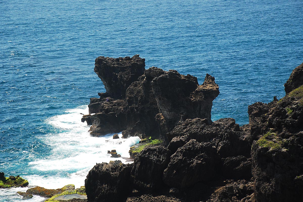
Maobitou(Cat-like Rock)
Maobitou is approximately 3.5km from Baisha. The name was given to a large coral rock that rolled from the sea cliff and looks like a squatting cat, hence its name. Maobitou is the point where Taiwan Strait meets Bashi Strait, and form the two southernmost points of Taiwan with Eluanbi. Maobitou is the classical eroded coral reef coastal terrain, which looks like a girl’s pleated skirt, thus it is also known as skirt reef coast. With constant erosion by the waves, endless cycles of wet and dry conditions, long-term salt crystal accumulation, sand drilling and dissolution, peculiar landscapes like cliff landslides, pot holes, reef pinnacles, interlayer caves are formed, all of which are of significant value in geological education and research.
There is a large variety of alge species here, and with the winter weather suitable for algae growth, green sea lettuces,brown sargassum and red algae can be seen in abundance here, flowing with the waves, creating a scenic contrast between the blue waters, the colorful tropical fishes, and the menacing coral rocks.
A large fallen rock named Leidashi lies on the route from Maobitou to Houbi lake, where the nearby beach is quiet and a good place to go shell hunting. The area is also famous for its beach rock terrain.
Information: Kenting National Park website
Featured tour routes
【1 day routes】
【Route 1】
Arrive at Kenting→ tourist center→Kenting forest recreation area (or Shirding nature Park)→Lunch→Chuanfan Rock→Shadao shell sand exhibition center→Eluanbi Park → Fongchueisha→return trip【Route 2】
Arrive at Kenting→Sisal Industry Historical Exhibition→Longluantan nature center→Houbi lake harbour→Chushuikuo →Maobitou Park →Baisha →Western coastal scenic road →return trip【Route 3】
Arrive at kenting→Chuanfan Rock→Shadao→Eluanbi Park→Longpan grassland→Fongchueisha→Jialeshui→Chuhao →Dongmen→return trip
【2 days route】
【Route 1】
Day 1:Arrive at Kenting→ tourist center→Kenting forest recreation area (or Shirding nature Park)→Lunch→Chuanfan Rock→ Shadao shell sand exhibition center→Eluanbi Park→Fongchusisah→Lodging at Kenting Youth Activity Center→night activities: stargazing at Longpan Park (or Chuhao, lighthouse, wander the Kenting main street)Day 2:Breakfast→South Bay →Sisal Industry Historical Exhibition →Longluantan nature center →Houbi lake harbour tour → lunch →Maobitou Park →National Museum of Marine Biology →return trip
【3 days route】
Day 1:Arrive at Kenting→ tourist center→lunch →Frog rock trail→ Kenting forest recreation area (or Shirding nature Park)→ Small Bay beach →Lodging at Kenting Youth Activity Center→night activities: stargazing at Longpan Park.Day 2:Breakfast →Chuanfan Rock→ Shadao shell sand exhibition center→Eluanbi Park → Longpan Park →Fongshueisha →lunch → Hangchun old city → National Museum of Marine Biology→ Lodging at Kenting Youth Activity Center→night activities: or Chuhao, lighthouse, wander the Kenting main streetDay 3:Breakfast →Sisal Industry Historical Exhibition →Longluantan nature center →Houbi lake harbour tour → lunch → Maobitou Park →Baisha → Guanshan views → Various western coast scenic views →return trip
【Forest recreation area 】
Day 1:● Day 1: Giant autumn maple tree (an ancient 300-year old tree that has been fighting for territory with the coral rocks)→flower shrine (tropical plant tour) → stalagmite cave (explore the limestone cave created by the rising coral reefs)→Cacti greenhouse (view cacti from all around the world) →looking glass tree (view the tree that has lived for over 400 years) → Yinlong cave (stalactite that looks like dragon scales) → white barkfig valley (enjoy the spectacular sights created by winding and twisting aerial roots of the barkfigs) → Yixiantien →Di-yi gorge (view and understand how the weathering of coral rock fault creates such a scenery) → Qi-yuan cliff